About Nyainqentanglha Mountain
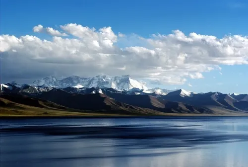
The Nyainqentanglha mountain range is a massive natural glacier barrier crossing central and eastern Tibet. Its main peak reaches 7,111 meters, covered in thick snow all year round, standing like a mighty giant in sil...
The Nyainqentanglha mountain range is a massive natural glacier barrier crossing central and eastern Tibet. Its main peak reaches 7,111 meters, covered in thick snow all year round, standing like a mighty giant in silver armor over the vast northern Tibetan grasslands. This range serves as the watershed between the Yarlung Tsangpo and Nujiang river systems, and is one of the most iconic natural spectacles in northern Tibet.
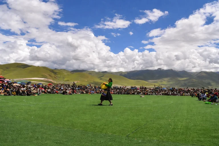
In Tibetan mythology and the ancient Bon religion, Nyainqentanglha is deeply venerated as the powerful mountain god ruling the northern grasslands and the husband of the holy lake Namtso. These two divine beings — sacred mountain and holy lake — have watched over each other for eternity, forming the most romantic and famous legend in Tibetan cosmology. On the vast grasslands at the mountain’s foot, herds of yaks and sheep graze peacefully against the backdrop of immense, connected snow peaks, composing a picture of absolute purity from the snow-covered pastoral highlands.
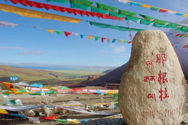
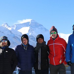
For most tourists, the first encounter with Nyainqentanglha happens on the road to Damxung or Namtso. The government has built an excellent observation deck along the G109 highway, complete with mani stone cairns and Buddhist stupas. On clear days, visitors can distinctly capture the magnificent silhouette of the main peak piercing through the deep blue sky, and feel the overwhelming grandeur of nature at its most powerful.
↺ History
For thousands of years, Nyainqentanglha has been regarded as a supreme sacred realm by Tibetan people and nomadic tribes. Throughout the long river of history, countless pilgrims have stopped in their tracks upon sighting this divine mountain, prostrating themselves in devout full-body prayer. The colorful prayer flags and towering mani stone cairns found everywhere at the mountain’s base are the crystallized faith of countless generations of believers.
In the process of modernization, Nyainqentanglha has also witnessed the birth of the “Road to Heaven.” The Qinghai-Tibet Highway (G109), built in the 1950s, and the later world-renowned Qinghai-Tibet Railway, both wind closely along the foot of this sacred mountain. The completion of these routes shattered the millennia-old silence of this remote wilderness, transforming a snowy wonder once visible only to eagles and nomads into a spectacular mountain panorama accessible to travelers from around the world.
Today, this area is not only an important religious pilgrimage destination but is also increasingly hosting various high-altitude mountaineering expeditions led by professional climbing teams, attracting the attention of extreme mountain adventurers from across the globe. The mountain’s challenging terrain and pristine environment continue to draw those seeking to test their limits against one of the Tibetan Plateau’s mightiest peaks.
Recommended Tours
View All
6 Days / 5 Nights ★ 4.8
6 Days Tibet Panorama Tour with Nyingchi, Everest & Namtso
3 Days / 2 Nights ★ 4.8
3 Days Nyingchi Grand Canyon & Basum Tso Tour
3 Days / 2 Nights ★ 4.8
3 Days Everest Base Camp Tour from Lhasa
How To Get There
The Nyainqentanglha observation deck is located in Damxung County, approximately 160 kilometers from Lhasa. It sits directly on the route from Lhasa to Namtso, making it a natural and convenient stop on the journey northward.
The most common way to reach the observation deck is by chartered car or self-driving. Departing from Lhasa, travel along the smooth and well-paved G109 highway (Qinghai-Tibet Highway) heading northwest. The drive takes approximately 2.5 to 3 hours. This scenic route runs alongside tributaries of the Lhasa River and the seemingly endless Damxung grasslands, making it one of the most beautiful road trips in Tibet. Drivers heading to Namtso will typically stop here voluntarily to let passengers rest and take photographs.
As this is not an enclosed scenic area but rather a magnificent natural viewpoint beside the highway, most visitors spend 20 to 30 minutes here. There is ample roadside parking and the observation deck is easily accessible from the highway.
ⓘ Travel Tips
- Best Time to Visit: May through October is the suitable season, but catching a clear view of the peaks depends heavily on the weather. If you encounter rain, snow, or thick cloud cover on an overcast day, the main peak can be completely obscured from view. Early mornings and late evenings offer the softest light and are the best times for photographing the golden-tipped snow peaks.
- Cold Weather Warning: Despite the observation deck being on the roadside, the altitude here is already approximately 4,600 meters. At this elevation, even in the peak of July summer, the glacial wind blowing directly from the snow-capped peaks can feel piercingly cold the moment the sun ducks behind a cloud. It is essential to put on your windproof jacket (hardshell or down jacket) and hat before stepping out of the vehicle.
- Altitude Precautions: This is often the first high-altitude point that visitors reach after leaving Lhasa. Do not let the excitement of seeing the magnificent snow mountains lead you to run or shout loudly. Keep your movements slow and deliberate, giving your body a buffer period to adjust to the rising altitude. If you feel dizzy or short of breath, return to the vehicle and rest.
- Photography Etiquette: Local Tibetan people near the observation deck often have beautifully decorated white yaks or Tibetan mastiffs available for tourist photos. If you want to include them in your landscape shots, always negotiate the price with the owner beforehand to avoid misunderstandings and disputes.
Enjoy Visa-Free Travel To China & Tibet
China has expanded visa-free entry policies for more countries. Our team can help confirm your route, permits, and documents before departure.
Gallery