About Serkyem La Pass
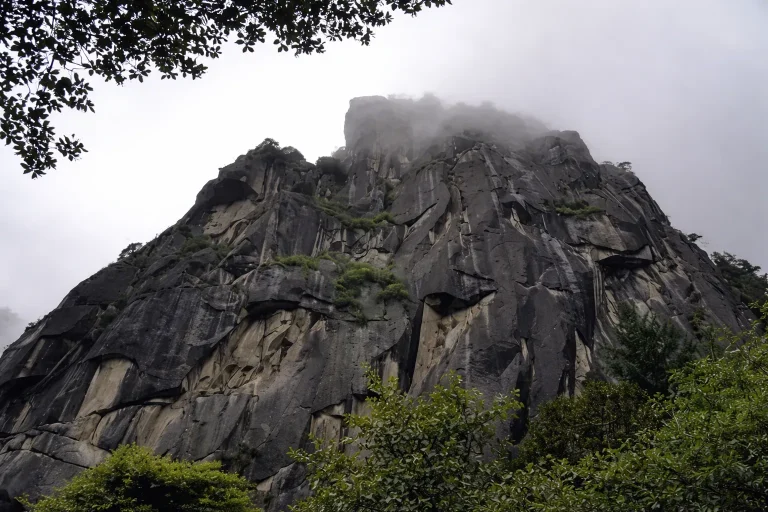
Serkyem La Pass (also known as Mount Sejila), commanding the sky at a formidable elevation of 4,728 meters in the Bayi District of Nyingchi, acts as the colossal, heavily forested geographical divide between the Nyang...
Serkyem La Pass (also known as Mount Sejila), commanding the sky at a formidable elevation of 4,728 meters in the Bayi District of Nyingchi, acts as the colossal, heavily forested geographical divide between the Nyang River Valley and the Parlung Tsangpo River Valley. As one of the most famous, utterly breathtaking, and notorious high-altitude mountain passes situated directly along the legendary National Highway 318 (the Sichuan-Tibet Highway), it stands as an absolute mandatory milestone for every single road trip into central Tibet.
The global fame of Serkyem La rests largely upon two undisputed visual miracles. The first is its status as the absolute premier, sweeping “God’s-eye” observation deck for viewing Mount Namcha Barwa. When meteorological luck aligns and the notoriously thick cloud cover breaks, standing on the windswept summit of this pass offers an aggressively unobstructed, panoramic view. The terrifyingly sheer, razor-sharp, 7,782-meter peak of “China’s Most Beautiful Snow Mountain” suddenly violently erupts across the eastern horizon, entirely dominating the vast sea of clouds below it in a display of absolute natural supremacy.
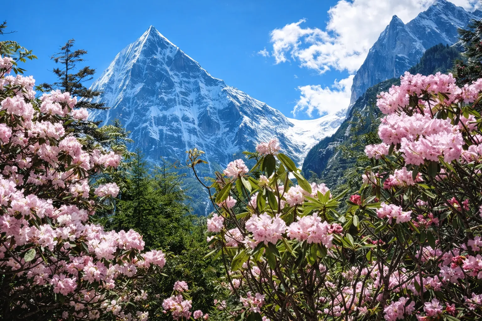
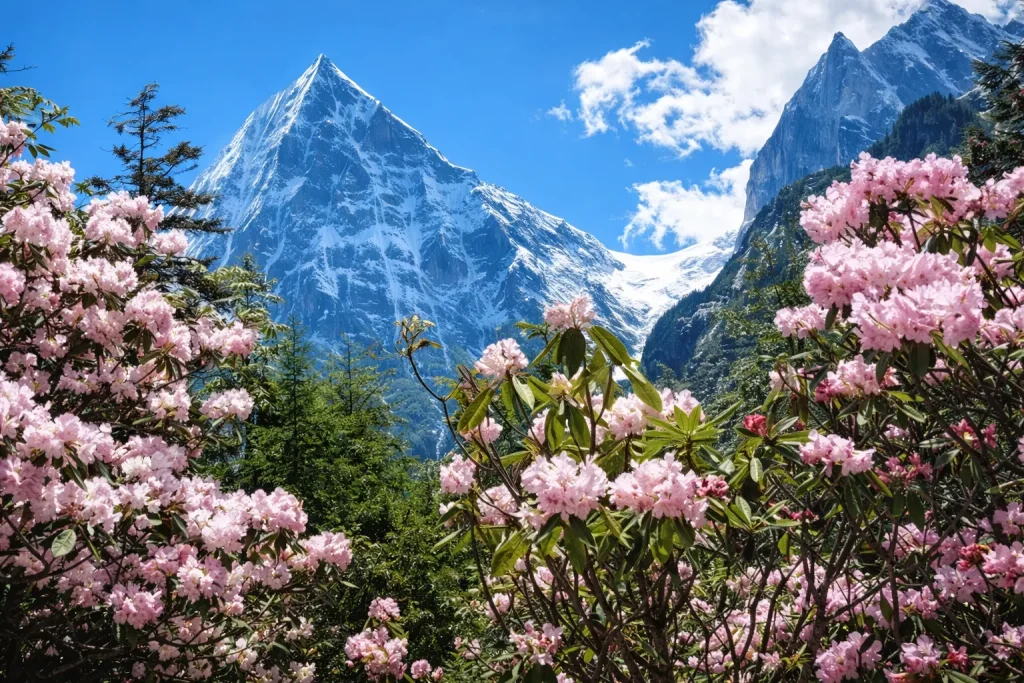
The second breathtaking spectacle is the mind-bending “Ocean of Rhododendrons.” Unlike the small, fragile alpine blossoms found at lower altitudes, the immense, sweeping slopes of Serkyem La are heavily blanketed by dozens of wildly rugged, gigantic species of high-altitude rhododendron trees. During their explosive peak blooming season, entire mountainsides are furiously painted in aggressive, saturated swaths of brilliant purple, vibrant yellow, crimson red, and pristine white, creating a surreal, kaleidoscopic contrast against the dark green primeval spruce forests.
↺ History
Within traditional Tibetan geography and deep-rooted spiritual beliefs, Mount Sejila commands profound reverence. It is officially worshipped as a highly sacred mountain by the indigenous Gongbo Tibetans of the Nyingchi region. Every year, coinciding with the deeply auspicious “Saga Dawa” festival (usually falling between April and May on the Gregorian calendar), thousands of passionately devoted locals purposefully brave the freezing high-altitude winds and dense, unpredictable forests to undertake a grueling, multi-day traditional circumambulation (Kora) around the entire mountain, fervently praying for divine blessings and bountiful harvests.
From the perspective of modern human engineering, the historical conquest of the Serkyem La Pass ranks as one of the most agonizing, catastrophically difficult, and blood-soaked chapters during the 1950s construction of the original Sichuan-Tibet Highway. The terrifyingly steep alpine gradients, the relentless, torrential monsoon rains, lethal mudslides, and catastrophic winter snowstorms transformed the task of carving a functional dirt track over this specific ridge into a harrowing, deadly miracle of infrastructure.
Today, that terrifying, vehicle-swallowing dirt track has been entirely annihilated and replaced by a beautifully paved, wide, flawlessly engineered black asphalt highway. The exact summit of the pass (the 4,728m marker) has been comprehensively developed with massive, robust concrete viewing platforms, sprawling matrices of violently flapping colorful prayer flags, and expansive parking areas. This modern development has permanently cemented its status as an obligatory, monumental photographic checkpoint where every overland traveler must stop to prove they conquered the pass.
Recommended Tours
View All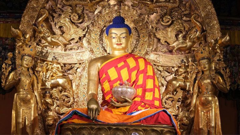
3 Days / 2 Nights ★ 4.8
3 Days Nyingchi Grand Canyon & Basum Tso Tour
6 Days / 5 Nights ★ 4.8
6 Days Tibet Panorama Tour with Nyingchi, Everest & Namtso
3 Days / 2 Nights ★ 4.8
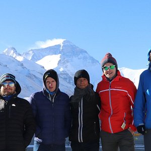
3 Days Everest Base Camp Tour from Lhasa
How To Get There
Geographically and strategically, the Serkyem La Pass sits decisively on the absolute main artery of the G318 National Highway. It functions as the unavoidable, towering geographic bottleneck exactly halfway between the bustling commercial center of Nyingchi (Bayi Town) and the incredibly lush, internationally famous Lulang Forest.
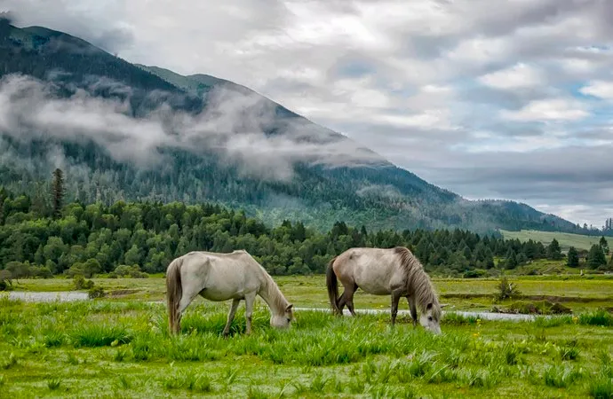
Departing eastward from downtown Bayi, the spectacular drive to the summit demands approximately 1.5 to 2 hours of relentless, steeply winding ascent covering about 50 kilometers. The journey is an astonishing ecological fast-forward: vehicles snake seamlessly out of the warm, humid, broadleaf valley floor, aggressively climbing through increasingly ancient, moss-draped, primeval spruce and fir forests. Finally, as the altitude approaches 4,500 meters, the tree line abruptly shatters, giving way to the stark, wildly exposed alpine tundra and dwarf shrubs that define the mountain saddle.
Because Serkyem La is a natural high-altitude mountain pass strictly integrated into a major, free-flowing trans-provincial highway—rather than a closed-off, commercially ticketed scenic park—it remains entirely open, toll-free, and accessible to all vehicles 24/7 (barring severe, road-closing winter blizzards). There are absolutely no entrance gates or mandatory official shuttle buses; you simply park your car on the massive shoulder at the summit marker and instantly step out into the howling alpine wind.
ⓘ Travel Tips
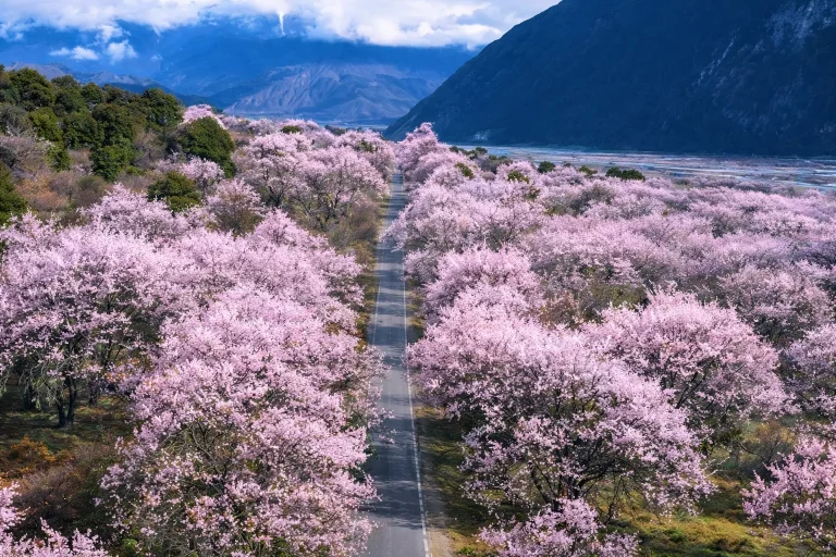
- The Ultimate Rhododendron Explosion: While Nyingchi as a whole is globally famous for its March peach blossoms in the valleys, Serkyem La absolutely dominates the late spring/early summer aesthetic. The unbelievably dense, wild rhododendron forests covering these high-altitude slopes reach their most violent, colorful climax specifically between mid-May and late June . If your itinerary aligns with this highly specific window, you will witness entire mountainsides blooming in aggressive, hyper-saturated colors against the dark green pines—a floral spectacle that arguably rivals the peach blossoms in sheer scale.
- Defending Against Lethal Alpine Wind: Despite Nyingchi's heavily marketed reputation as a "warm, low-altitude, oxygen-rich" region, do not be foolishly deceived by the Serkyem La Pass . At 4,728 meters, the exposed summit acts as a brutal, high-velocity atmospheric wind tunnel. Even under the scorching, blinding UV rays of mid-July, the screaming gales ripping across the pass will instantly cut right through summer clothing, plummeting the wind-chill factor dangerously close to freezing. Before daring to step out of your heated car to photograph Namcha Barwa, you must heavily armor yourself in a thick, completely windproof hardshell jacket and a secure hat that violently covers your ears. An unprotected 60-second photo op here frequently results in a catastrophic, trip-ruining altitude migraine.
- Strategic Timing for Namcha Barwa: While the pass undeniably offers the single most dramatic, sweeping wide-angle panorama of Mount Namcha Barwa in all of Tibet, defeating the "Shy Mountain's" infamous, impenetrable cloud cover requires surgical timing. The absolute highest statistical probability of witnessing the 7,782m peak perfectly clear from this specific vantage point occurs during the crisp, bone-dry atmospheric conditions of mid-to-late Autumn (October to November) . Even during these optimal months, arriving in the freezing, crisp early morning hours (before 10:00 AM) drastically maximizes your chances of a clear shot before the midday thermal convection inevitably forces massive, blinding clouds to rise from the canyon directly below the peak.
Enjoy Visa-Free Travel To China & Tibet
China has expanded visa-free entry policies for more countries. Our team can help confirm your route, permits, and documents before departure.
Gallery